
Elevate Your Insights with Our Aerial Surveying Services
Precision from Above for Every Property Need
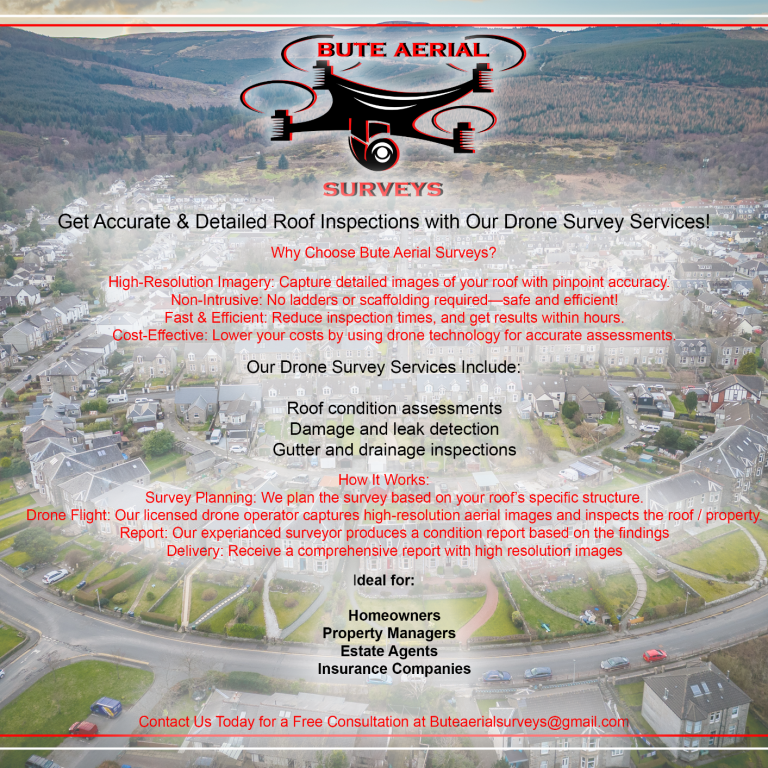
Bute Aerial Surveys – Website Information & Services Overview
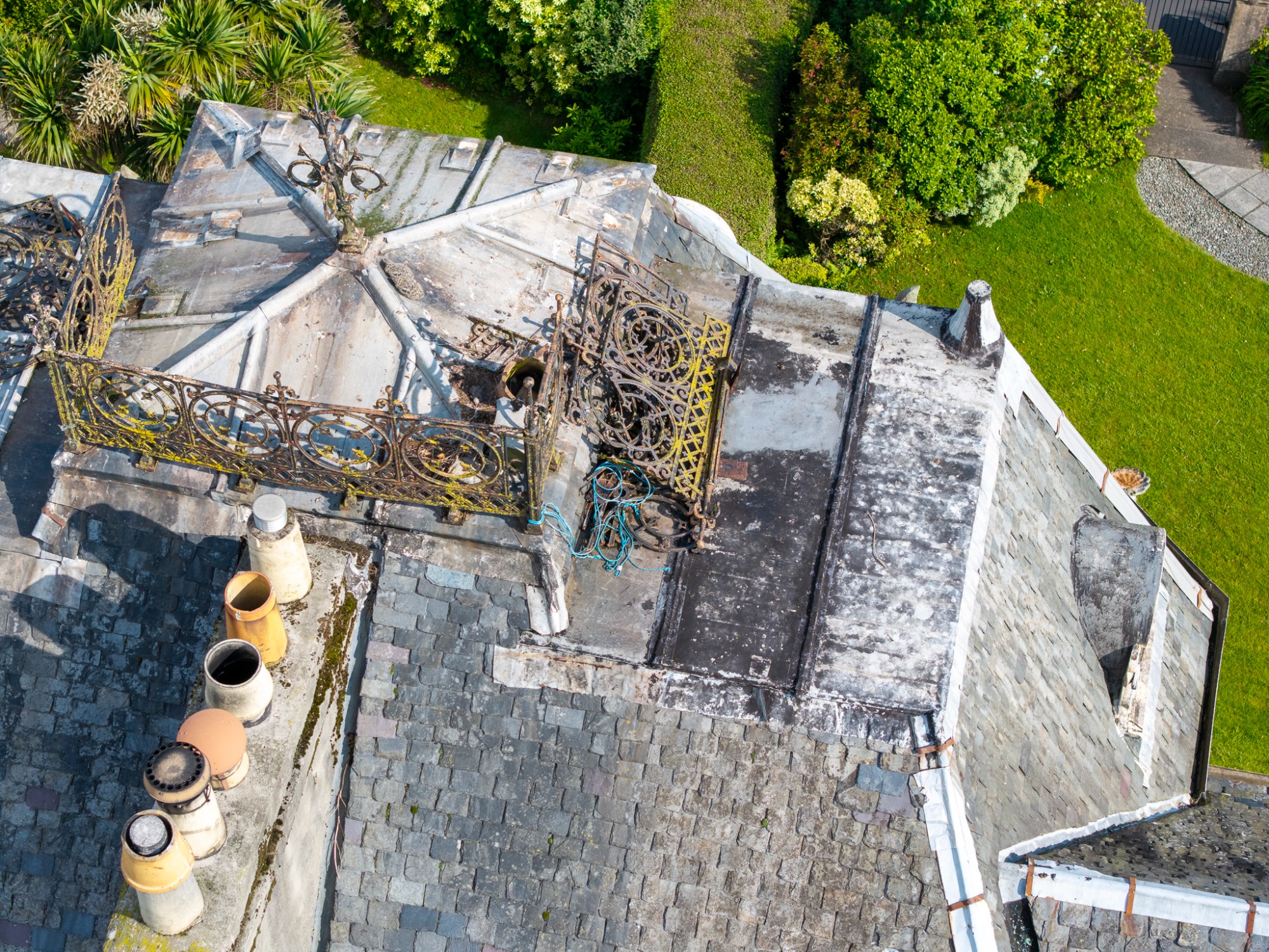
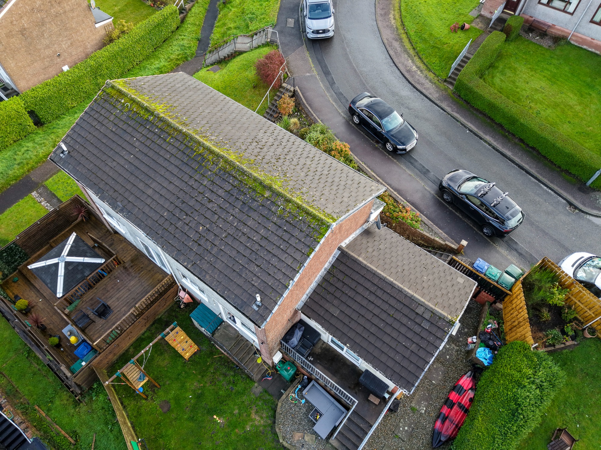
Bute Aerial Surveys provides professional drone photography and inspection services across the Isle of Bute and surrounding areas including Argyll and the West Coast of Scotland. Using high-resolution drone technology, we capture precise aerial imagery for a wide range of applications — from roof and chimney inspections, property condition surveys, and estate marketing, to construction progress reports, landscape photography, and mapping projects.
With over 20 years’ experience in the construction and surveying industry, we combine technical knowledge with creative aerial imaging to deliver accurate, detailed results. All operations are fully CAA certified, insured, and carried out using advanced DJI drone equipment to ensure safe, compliant, and reliable data collection.
Whether you’re a homeowner, estate agent, contractor, or local business, our aerial photography and surveys offer a cost-effective way to assess hard-to-reach areas without the need for expensive scaffolding or access equipment. Services start from just £80, with clear digital reports and images delivered promptly.
Elevated Perspectives for Property Insights
Your Vision from Above
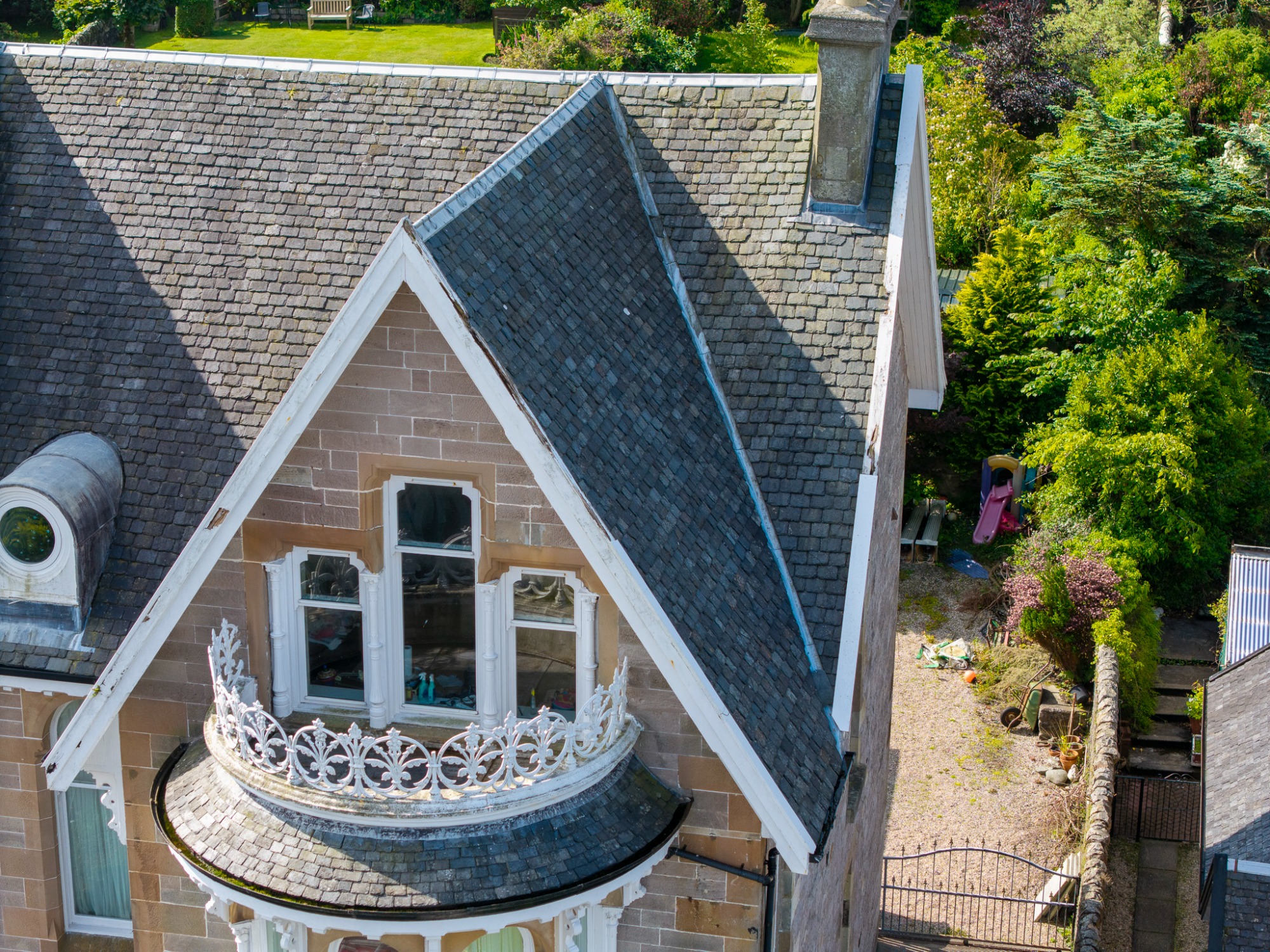
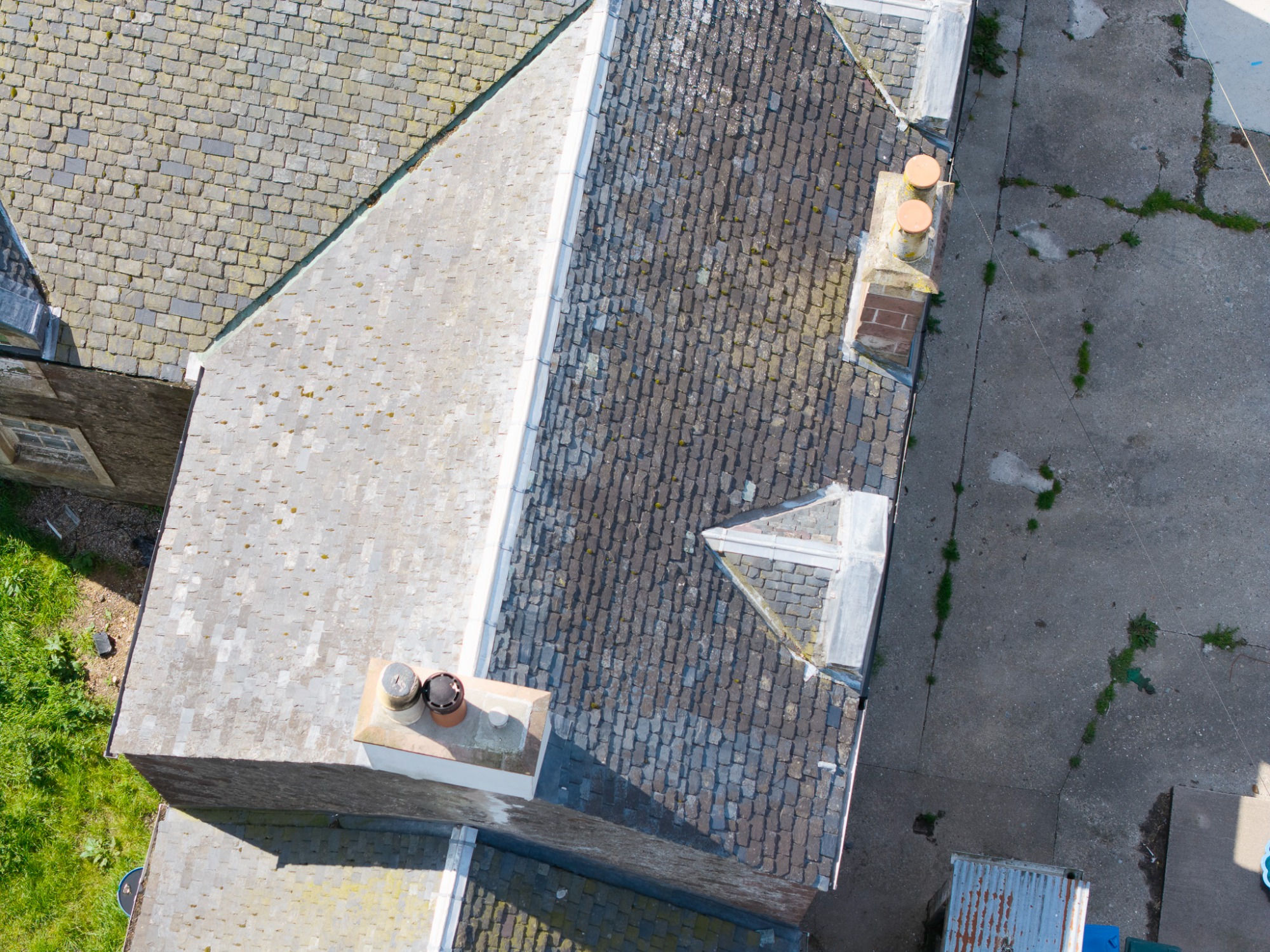
Experience the benefits of aerial photography with Bute Aerial Surveys. Our surveying packages are designed to give you unprecedented access to detailed visual data, helping you make informed decisions about property maintenance and repairs. Perfect for both residential and commercial properties, our high-resolution aerial images provide unique insights that ground-based photography simply cannot match. From inspecting roof conditions to surveying land, our services empower you to manage and maintain your properties effectively. Trust Bute Aerial Surveys to elevate your perspective and enhance your property decisions.
Image Gallery of Aerial Surveys
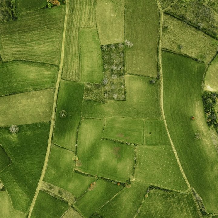
Explore our stunning aerial imagery that captures the beauty of the Isle of Bute. Our image gallery showcases the precision and quality of our surveys, providing a visual representation of our work and the areas we cover. Each image is meticulously captured to highlight the unique landscapes and landmarks of this picturesque island, illustrating our commitment to excellence in aerial photography and surveying services.
Explore the Aerial Surveying Process
At Bute Aerial Surveys, we pride ourselves on delivering exceptional aerial surveying services tailored to the unique demands of each project. Our streamlined process employs the latest technology, ensuring accuracy and efficiency while gathering vital data from above. Learn about our comprehensive approach and the sophisticated techniques that define our commitment to quality in aerial surveying.
Types of Aerial Imagery
Capturing Perspectives from Above
Our aerial surveying services encompass a variety of service types, including different packages for specific budgets. Each type serves distinct purposes, from detailed photo surveys to reports highlighting works required and or storm damage. By utilising advanced drone technology, we ensure that clients receive the most accurate visual insights.
Thorough Inspection Procedures
Ensuring Comprehensive Evaluations
Bute Aerial Surveys employs meticulous inspection procedures to assess sites effectively. Our experienced operator conducts thorough aerial inspections, which highlight structural integrity and environmental conditions. This attention to detail guarantees prompt identification of potential issues, empowering clients with the information necessary for informed decisions.
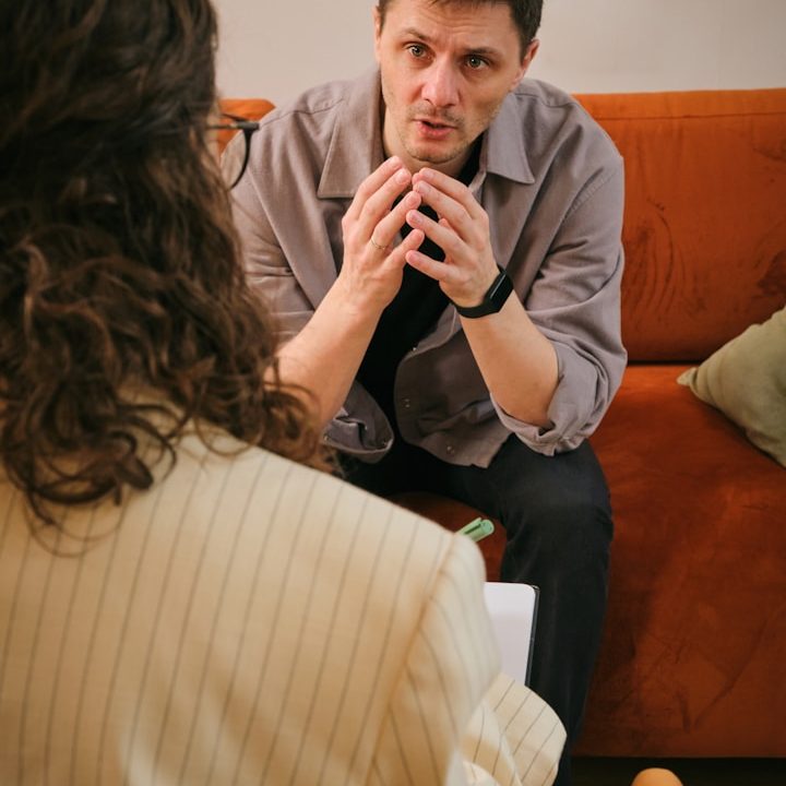
Client Success Stories
Our Commitment to Quality
We believe in building trust and transparency with our clients. Our testimonials reflect the satisfaction of those who have experienced our aerial surveying services first-hand. Each story underscores our dedication to precision, service excellence, and the seamless integration of technology to meet client needs.
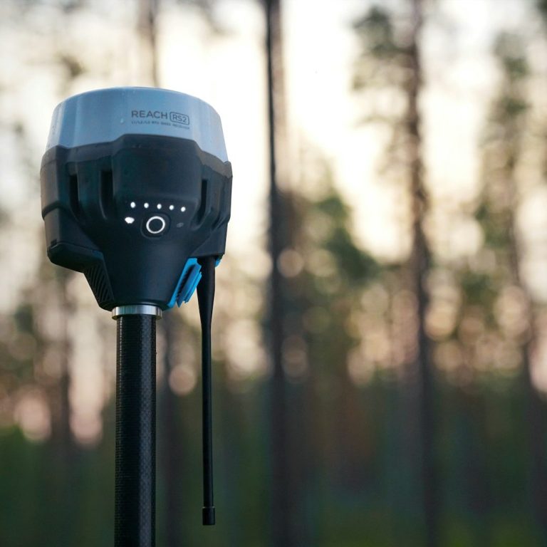
Innovative Survey Technologies
Leading the Way in Aerial Solutions
Utilising state-of-the-art technology, Bute Aerial Surveys integrates cutting-edge drones equipped with high-definition cameras and sensors. These enable us to capture extensive data accurately and efficiently, enhancing project outcomes. Our commitment to innovation ensures we remain at the forefront of aerial surveying practices. A2 cofc qualified and fully insured
Contact Us for Aerial Surveying
Get in touch with us today to discuss your aerial surveying needs or to request a quote. At Bute Aerial Surveys, based in the picturesque Isle of Bute, we are committed to delivering professional and efficient aerial surveying services tailored to your requirements. Our contact form is designed for your convenience, ensuring that we respond promptly to your inquiries about our surveying packages. Whether you have questions about our methodologies, pricing, or specific service offerings, our dedicated team is here to assist you. Reach out today and let us help you capture the aerial views that matter to you.